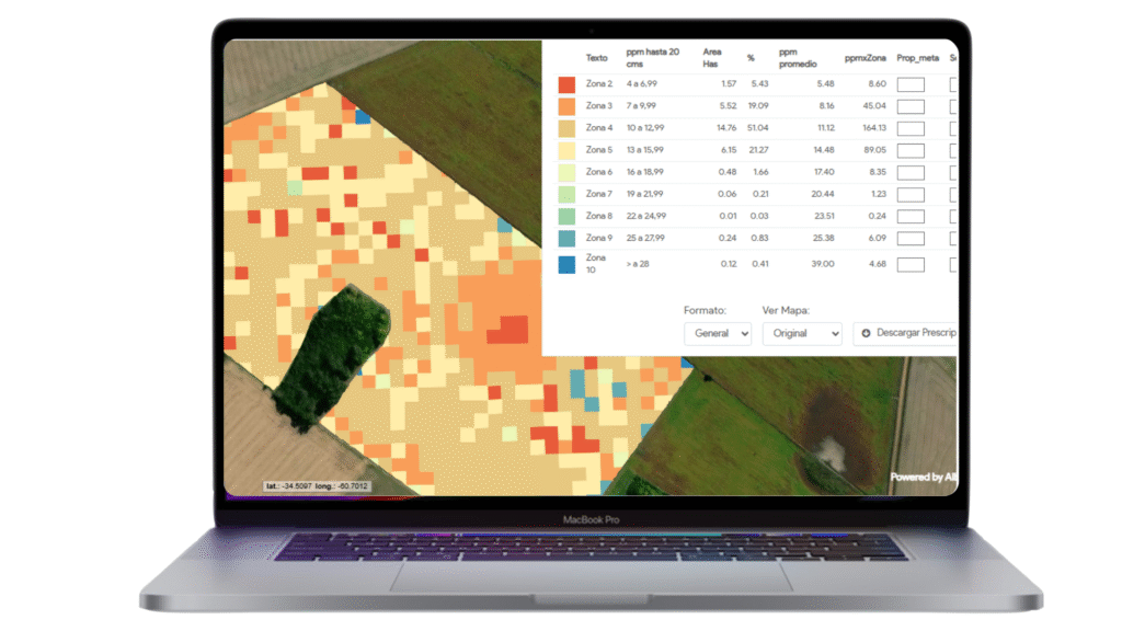
This map displays the available phosphorus (PO4) levels in the soil, measured in ppm (parts per million), both with and without green cover, up to 20 cm depth.
🌿 What Is Phosphorus?
Phosphorus is an essential macronutrient widely used in agriculture. Its roles include:
Stimulating root development
Enhancing flowering and seed formation
Supporting the accumulation and transformation of organic matter (OM)
Its availability can vary greatly over time due to interactions with soil texture, pH, moisture, and biological activity.
📊 Why This Map Matters
Helps you locate phosphorus-deficient areas
Informs targeted fertilization strategies
Reveals the impact of cover crops or vegetation on phosphorus retention
Crucial for improving soil health and sustainability
💡 Key Insight:
Phosphorus not only supports plant growth but also enhances microbial activity and helps in building long-term soil fertility. Monitoring its distribution helps avoid overuse or underuse, saving costs.
Maps are available in 10 x 10 m resolution.
Available images every 5 days.
Table of contents including detailed parameters
Time lapse graphics to evaluate trends and deviations.
Prescriptions for fertilizers application available.

 Available images every 5 days.
 Table of contents including detailed parameters
 Time lapse graphics to evaluate trends and deviations.